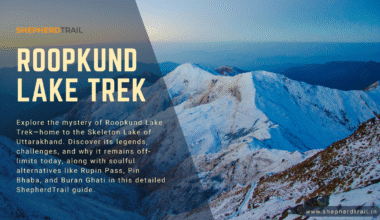
Buran Ghati Trek: Your Next Unforgettable Himalayan Adventure | A detailed guide by Shepherd Trail
If there’s one trek in India that offers the perfect blend of adventure, natural beauty, and a taste of all Himalayan terrains in one journey — it’s the Buran Ghati Trek. Nestled in the heart of Himachal Pradesh, this trail is a dreamy escape for nature lovers, thrill-seekers, and trekking enthusiasts alike. Whether you’re hiking through lush pine forests, camping in vast meadows, or rappelling down icy walls, Buran Ghati promises a rollercoaster of unforgettable moments.
The untouched Buran Ghati Trek is the less-travelled, less-revealed trek in the central hills of the Himalayas. It is adorned with the most exciting river crossings, High snow walls, beautiful forests, endless grasslands, mountain peaks and villages you’ve never dreamed of. Buran Ghati is unquestionably the most amazing and adventurous trek. The trek takes you to the tremendous walkway marked in the middle of the snow Mountains. Where the walk ends, rappling begins, where rappling ends, discovery begins.
So tighten your boots, grab your backpack, and let’s dive deep into everything you need to know about this incredible journey!
🗺️ About the Buran Ghati Trek
- Location: Himachal Pradesh, India
- Altitude: 15,000 ft (approx.)
- Duration: 7-8 days
- Difficulty Level: Moderate to Difficult
- Starting Point: Janglik
- Ending Point: Barua village
- Average Temperature: Day time -: 12-18°C, Night time -: -10°C
This trek starts from the charming village of Janglik, which is around 150 km from Shimla. As you ascend, the landscape keeps changing — dense forests, blooming meadows, icy lakes, and finally, the snow-covered Buran Pass. Every day feels like a new adventure.
🌤️ Best Time to Do the Buran Ghati Trek
The trek is typically accessible during two major windows:
- May to Mid-June: Perfect for snow lovers! Expect to walk on thick snow sheets near the pass. The contrast of green forests and snow-laden trails is absolutely surreal.
- Mid-September to October: Experience the mountains in autumn glory. Meadows turn golden, skies are crisp and blue, and you’ll likely avoid the crowds.
Each season paints a different picture, so choose the one that resonates most with your adventure goals!
🌸 What to Expect in Different Seasons on the Buran Ghati Trek
One of the best things about the Buran Ghati trek is how dramatically it changes with the seasons. If you’re trekking in May or early June, get ready for a magical experience — snow blankets the upper trails, and you’ll be sliding down icy slopes and walking through snowy meadows. The contrast of green pine forests against the white snow is absolutely breathtaking! As the season shifts to late June and into October, the snow recedes, revealing vibrant green valleys, blooming wildflowers, and golden meadows. This is when the trek is alive with color and the weather is just perfect for long hiking days. No matter when you go, the views are unforgettable — but your experience will definitely vary depending on the season!
🥾 Trekking Highlights
- 🌲 Enchanting Pine Forests near Janglik
- 🌼 Dayara Meadows – Carpet of flowers and endless green
- 🏕️ Camping beside the serene Chandranahan Lake
- ❄️ Snow walls and thrilling rappelling near Buran Pass
- 🏔️ Jaw-dropping views from the 15,000 ft high Buran Pass
🗓️ Detailed Itinerary
Here’s a day-by-day breakdown to help you plan:
Day 1: Reach Janglik (9,200 ft)
Drive from Shimla to Janglik (Approx. 8-9 hours). This charming little village is the starting point of your trek. This untouched trek begins at Janglik, a village situated in the upper region of Shimla District at left bank of Pabber river.
Day 2: Janglik to Dayara Thatch (11,075 ft)
Trek through pine and oak forests. Gradual ascent. Camp in open meadows. One can explore the village. The village is pure heritage and full of photographers delight. The trek winds through the thick forests, beautiful meadows and grassy land ascents. It’s a moderate trek, takes around 4-5 hours to reach Dayara Thach.

Day 3: Dayara to Litham (11,800 ft)
Walk through rolling meadows and stream crossings. Litham is surrounded by snow-capped peaks. This trek promises you thick forest cover, fast gushing streams, meadows and an altitude of 737 feet within 3 hours. Through the Gunas Pass, snow clad Dhaulandhar range, Silver Birch leads you to the first clear view of Litham. Cross the Chandranahan stream to reach Litham campsite. Relax with the best spot on the camp to enjoy the rest of the evening in the laps of nature. A Three sided view of Litham makes it all the more picturesque. Chandranahan Waterfalls on your left followed by Chandranahan Lake and the snow-clad mountains.
Day 4: Acclimatization + Visit Chandranahan Lake (13,800 ft)
Short hike to the alpine lake. It’s glacial, serene, and spiritual. Chandranahan Lake constitutes of glacier tarn perennial snow flanks from its surrounding mountains. Take the shepherd’s trail to reach to top of the waterfall.
Chandranahan Lake take another 1 hour to reach from the waterfalls.
This lake promises you the view of a nestled bowl like glacial amphitheatre. Enjoy the snow and beautiful stone cairns before descending to Litham.
Day 5: Litham to Dhunda (13,000 ft)
A steep climb through boulders and moraine. Dhunda has epic views of the Buran Pass wall. A 4 hours trek from Litham Thach to Nalabansh at 13,000 feet.
Pass through the Rupin valley cliffs on the right. While descending the valley, you get the first view of Buran Ghati and Gunas Waterfall. So there are 2 options for this day for setting up the camp as per your choice.
-
Dunda is typically the base camp for the Buran Ghati Pass summit day. It is located at a higher altitude and closer to the actual pass. Most itineraries camp here just before attempting the summit and the descent via the snow wall. It offers panoramic views of snow-covered peaks and often has snow in early summer.
-
Nalabansh (sometimes spelled Nalabhanse) is another scenic campsite, usually located a day before Dunda when trekking from Litham. It lies in a beautiful meadow region surrounded by pine forests and alpine grasslands.

Day 6: Dhunda to River Camp via Buran Pass (15,000 ft)
Summit day! Trek to the pass, descend via snow slopes and rappel down. A thrilling day!
A typical question which most of the trekkers have in mind while booking the Buran Ghati Trek is which one of the below itineraries to be followed? So here is a quick comparison of both for you.
NALABANSH TO MUNIRANG VIA BURAN GHATI
Dhunda to River Camp via Buran Pass
“Nalabansh to Munirang via Buran Ghati” and “Dhunda to River Camp via Buran Pass” — are part of the same Buran Ghati Trek, but they reflect slightly different camp names and stages depending on how the trek operator structures the journey.
Here’s a detailed comparison:
✅ 1. “Nalabansh to Munirang via Buran Ghati”
-
Starting Point: Nalabansh (lower camp compared to Dhunda)
-
Summit Day: Long and challenging — from Nalabansh, you trek to Buran Ghati Pass and descend all the way to Munirang.
-
Total Distance: Longer summit day (approx. 12–14 km)
-
Challenge: This version is more strenuous as it includes gaining and losing a lot of elevation in a single day.
-
Used When: Sometimes used when Dhunda is inaccessible due to snow or when campsites are changed based on weather or group pacing.
✅ 2. “Dhunda to River Camp via Buran Pass”
-
Starting Point: Dhunda (higher camp closer to the pass)
-
Summit Day: Trek over Buran Ghati and descend to River Camp.
-
Total Distance: Slightly shorter and more manageable because Dhunda is closer to the pass.
-
Challenge: Steep descent but more balanced day; often considered ideal for summit day.
-
Used When: This is the more common itinerary if conditions are favorable. River Camp and Munirang are often interchangeable terms used for the post-pass campsite depending on the guide/company.
⛰️ Key Differences:
| Factor | Nalabansh Route | Dhunda Route |
|---|---|---|
| Starting Altitude | Lower | Higher |
| Summit Day Distance | Longer (~12–14 km) | Shorter (~8–10 km) |
| Effort Level | Higher due to more elevation gain | Balanced – Steep climb and controlled descent |
| Campsite After Pass | Munirang | River Camp (can be the same or nearby spot) |
| Preferred For | Emergency/weather changes, extra acclimatization | Ideal summit day when Dhunda is accessible |
🧭 TL;DR:
-
Dhunda to River Camp is the more typical and efficient summit day if weather and trail allow.
-
Nalabansh to Munirang is used when you camp lower, adding distance and difficulty.
Day 7: River Camp to Barua Village; Drive to Shimla
Descend through forest and orchards. Barua marks the end of this incredible journey. The end point of the trek, Barua village is a historical .The village set amidst the mountains, forests and grasslands and the most dangerous road which will take you to Sangla(The dream destination ).
🧭 Route Map

🛶 Adventure Meets Serenity: What Makes Buran Ghati Special?
It’s rare to find a trek that offers all terrains in one route. You get:
- Alpine lakes
- Dense forests
- Wildflower meadows
- Snow crossings
- Rappelling and technical descent
It’s a complete package for both new trekkers wanting a challenge and experienced hikers looking for diversity.
📸 Visual Treat: Nature and Culture
The cultural richness of Himachal is deeply woven into the villages you pass. Quaint wooden homes, warm locals, and apple orchards paint a picture right out of a storybook. Make sure to interact with the villagers — their stories add soul to your adventure.
🧳 Essential Packing List
Here’s what you need:
- Sturdy trekking shoes (waterproof)
- Down jacket, fleece, thermal wear
- Poncho or rain cover
- Trekking poles
- 3-4 pairs of socks, gloves
- Sunscreen, sunglasses, lip balm
- Power bank and head torch
- Water bottles, dry fruits, and energy bars
🏕️ Tips for a Safe and Enjoyable Trek
- Acclimatise properly. Don’t rush the itinerary.
- Carry a reusable water bottle and stay hydrated.
- Hire a certified guide or go with an experienced trekking group.
- Carry basic medications and a personal first-aid kit.
- Be respectful to nature – no littering!
📍How to Reach Janglik
- By Train: Reach Shimla via Kalka-Shimla toy train.
- By Road: Buses and taxis from Shimla to Rohru. Then a local cab to Janglik.
- By Air: Fly to Chandigarh or Shimla and take a road trip.
🔄 Alternatives to Buran Ghati
If you love Buran Ghati, here are some treks you’ll also enjoy:
- Rupin Pass Trek
- Hampta Pass Trek
- Bali Pass Trek
- Kedarkantha (for beginners)
📶 Mobile Network Availability on the Buran Ghati Trek
One of the most common questions trekkers have is about mobile connectivity. You’ll be glad to know that you’ll have a reliable mobile signal at Janglik, the base village of the Buran Ghati trek. In fact, most major networks like Jio and Airtel work well here. As you begin your hike, you’ll continue to have network access for the first 30 to 40 minutes of the trail. After that, expect to be completely off the grid — which, honestly, is part of the beauty of this trek. Disconnecting from the digital world allows you to fully immerse yourself in the stunning landscapes and raw mountain experience. Just make sure to send that last message home before you lose signal — and then get ready to tune in to nature instead!
Where to book Buran Ghati Trek
If you are planning to take this trek, you can contact Mr. Sanjay Negi (9816722069) from Hike In Himalaya. They have their own homestay in Janglik village and are experienced and managing this trek from last 15 years.
💬 Final Thoughts
The Buran Ghati Trek isn’t just a hike — it’s a journey into the heart of the Himalayas where every twist and turn tells a new story. From silent forests to snowy adventures and starlit campsites, this trek truly has it all.
So whether you’re an experienced trekker or a newbie ready to take the plunge, Buran Ghati welcomes you with open arms and stunning vistas.
Ready to chase adventure? The mountains are calling!